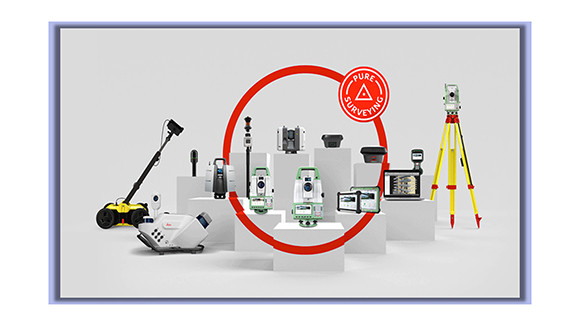

Industry-Leading Geospatial Products
Leica Geosystems stands as a global leader in geospatial technology, providing an extensive suite of industry-leading products such as surveying instruments, GPS/GNSS solutions, and total stations. Renowned for their precision and reliability, these instruments are the trusted choice of professionals worldwide, offering unparalleled accuracy across a broad spectrum of applications.

Autonomous Flying Laser Scanner
Embark on a transformative journey with Leica Geosystems' groundbreaking autonomous flying laser scanner, redefining the landscape of surveying and mapping tasks. This cutting-edge technology represents a paradigm shift, delivering unparalleled efficiency and accuracy.
Professionals can now effortlessly collect precise data from challenging terrains and once-inaccessible areas, unlocking new possibilities for exploration and analysis. Leica Geosystems continues to push the boundaries of innovation, empowering professionals with state-of-the-art tools that elevate the standards of geospatial data acquisition and mapping precision.
HxGN LIVE Global Event
Become part of the dynamic global community of professionals by attending the prestigious HxGN LIVE event hosted by Leica Geosystems. Immerse yourself in a platform designed for comprehensive knowledge exchange, hands-on training, and invaluable networking opportunities.
This event is dedicated to fostering innovation and collaboration within the geospatial industry, providing attendees with a unique and immersive experience to stay at the forefront of industry trends and advancements. Join us at HxGN LIVE and be a part of shaping the future of the geospatial landscape through shared insights and collaboration.

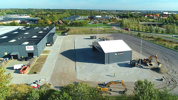
Advanced Building Ecosystem Solutions
Delve into the sophisticated building ecosystem solutions offered by Leica Geosystems, tailored to meet the distinctive requirements of construction and infrastructure professionals. Covering a spectrum from 3D laser scanning to reality capture and seamless Building Information Modeling (BIM) integration, these tools are designed to empower efficient project management and foster informed decision-making.
Elevate your capabilities and streamline workflows with Leica Geosystems' advanced solutions, providing a comprehensive suite of tools that revolutionize the way construction and infrastructure projects are planned, executed, and managed.